

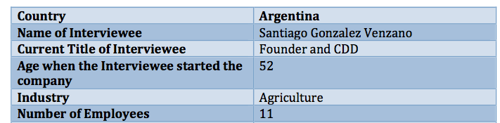
“With the global population expected to increase from 7.2B to 9.6B over the next 35 years, food supplies will have to increase by 70%,” states Santiago Gonzalez Venzano, Founder and CDD of S4 – an agriculture tech start up based in Buenos Aires, Argentina (and recently in Saint Louis, MO). Yet, in order to increase food supplies with available farmland, farmers need to more efficiently utilize their resources. One way S4 is helping to alleviate the burden on farmers is through “decision” agriculture, helping risk managers use high level precision agriculture information, based on satellite imagery, to reduce financial agriculture related risk. By analyzing a farm’s relative risk, S4 ultimately reduces the administrative costs for insurance companies, and as a result increases the available premium given to farmers.
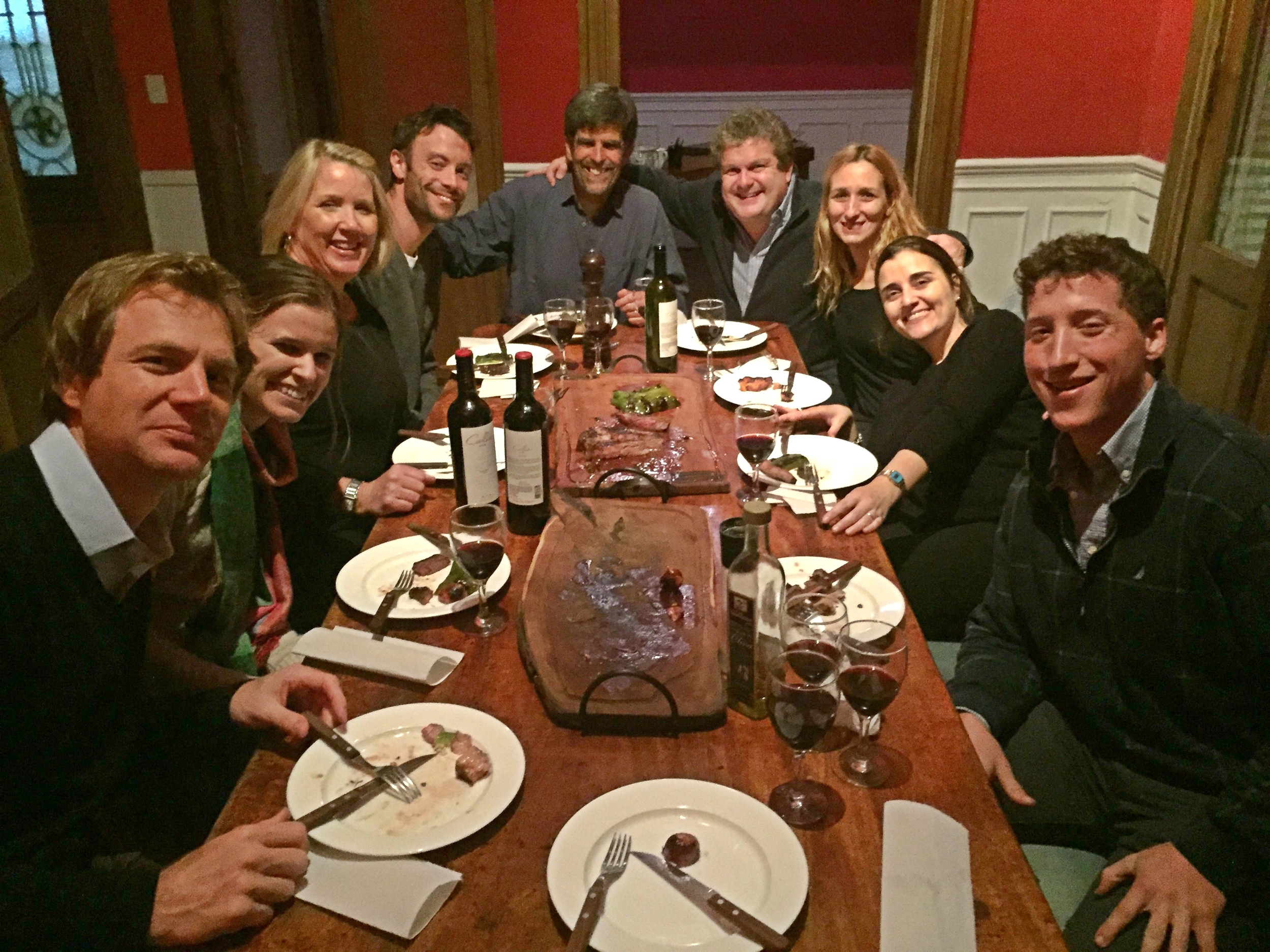
Having a traditional Argentine Asado or BBQ with the S4 Argentina-based team. Santiago Gonzalez Venzano, Founder and CDD of S4 is at the head of the table.
“Traditionally, insurance companies have two main costs when insuring crops,” says Santiago. “The pure risk or the amount that the insurance company is willing to provide to farmers if crops are damaged, and the administrative costs (like the cost to hire an inspector to estimate the risk).” For example, when a farmer purchases insurance for $100, about 50% to 60% of the insurance purchased will go to the pure risk; the rest is funneled to administrative costs. “Because we can notify the insurance company of the relative risk a farm has, we are able to boost the ratio of pure risk to administrative costs from about 60% pure risk to 70%. That means more money can be given to the farmer if their crops are damaged,” explains Santiago.
How does S4 measure relative risk? S4 measures 15 years worth of information on any given 12 acre satellite image, and benchmarks the management of that farm with its history the history of its neighbors.
Santiago is a trained agronomist and worked as an advisor to farmers on nutrient management for many years. “Growing up with hippies for parents, I’ve always had a very close relationship with nature.” Ten years ago, Santiago began to play with the idea of using data from satellite imagery to help farmers. After several years of working to prove the concept, Santiago formed S4 in 2011. Since then, S4 has expanded rapidly and now provides services to Argentina, Colombia, Uruguay and the USA. “Over the next five years I hope we will be in all continents, helping to improve the agricultural world.” And, with the onset of a growing population and the ever-increasing demand placed on farmers, we hope S4 is able to do just that.